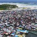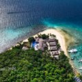


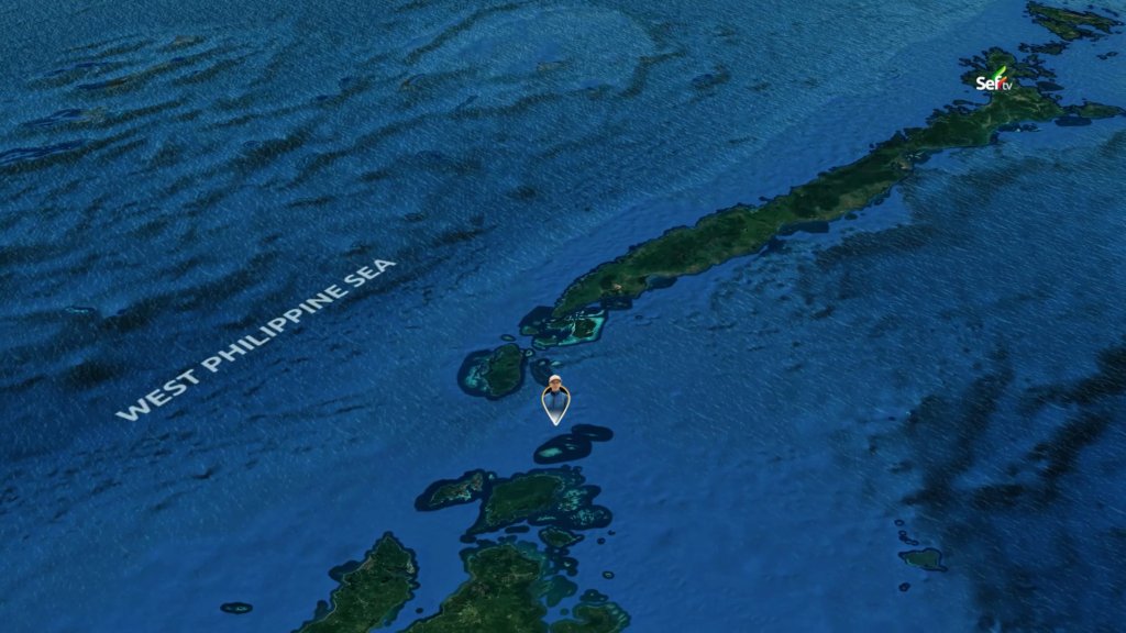
Mangsee Island— There is a place in the Philippines where your phone greets you with the words “Welcome to Malaysia” — even though you never left the country. That place is Mangsee, a remote island barangay of Balabac, Palawan, sitting right on the border between the two nations. More than ten thousand people live on this small island, most of them Muslim, and some with Malaysian roots.
I went there to see what life is like at the very edge of our map.
A Journey That Was No Joke
Getting to Mangsee tested my patience. The trip took one hour by air, five hours by land, and about six more hours on the water. Before the final crossing, we spent the night in the town center of Balabac, around forty kilometers from the southern tip of mainland Palawan, after a full day of island visits with Isla Malaya Travel and Tours.
Morning in Balabac came quietly. It was past six, but the sky was still a little dark when I stepped out of Julla Lodging House. A few residents were walking around, some were playing at the covered court, and others were still asleep. I wanted coffee, but the restaurants and shops were all still closed.
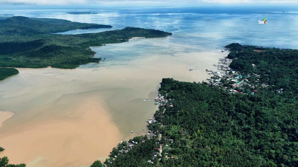
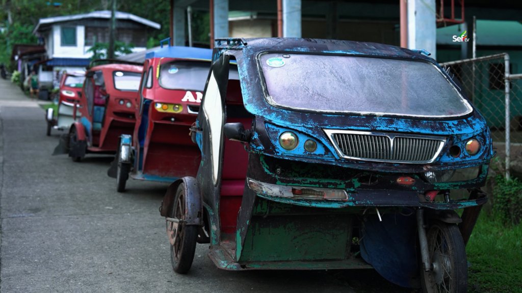
Balabac itself had small surprises. Along the shore, houses gather right on top of the water. The roads are paved, and tricycles serve as the main ride to the populated parts of the island — but these are not ordinary tricycles. They are designed to look like four-wheeled vehicles, complete with headlights, front grilles, windshield wipers, and even brand names like Nissan, Toyota, and Mitsubishi.
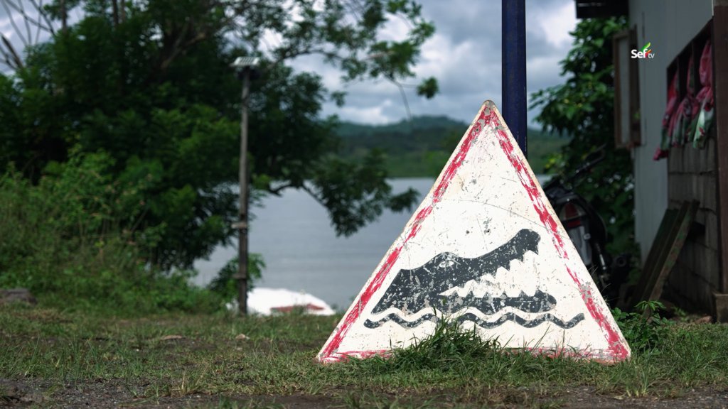
Near the small-boat harbor, a sign caught my eye: swimming is not allowed, because crocodiles are sometimes seen along the water’s edge. Beside it hangs a small piece of iron. When someone spots a crocodile nearby, they strike it like a bell to warn everyone in the area.
Crossing to Lumbucan
From the town center, our first stop was Lumbucan Island, about an hour and a half away by boat. I asked our boatman if the sea was always this rough. He said no — sometimes it is very calm, sometimes it is wavy, but what we were riding through that day was normal.
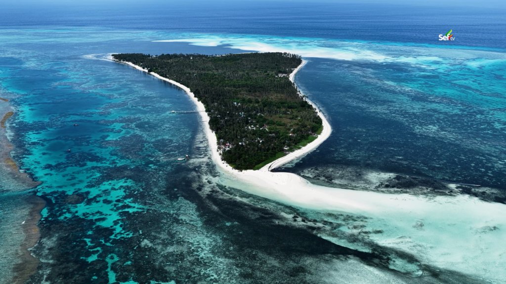
The municipality of Balabac is made up of thirty-six islands, known for beautiful beaches, an amazing sandbar, and rich waters. As we neared Lumbucan, the boat slowed down. The water turned a deep blue, then shallow, with rocks that could damage the propeller, so we crawled gently toward the shore.
Lumbucan welcomed us with children who spoke Tagalog but told me their own language was Ubian. The sand there is so fine it reminded me of cement powder. The houses come in matching colors — an orange roof with orange walls, a blue roof with blue walls — much like the homes I once saw on Panguan Island.
What touched me most was their way of sharing. I saw fish laid out and asked if it was for sale. It was not. When someone catches something, they give part of it to relatives and neighbors. That old custom is still alive there. They even offered us snacks — wafers with labels we could no longer read, because the products came from Malaysia. Although Lumbucan sits closer to the Balabac mainland, it actually falls under barangay Mangsee, which was still more than an hour away by speedboat.
The Rough Road to the Border
For the next leg, we switched to a smaller traditional boat with no outriggers. It looked less stable, but locals say it is faster and better at handling the high waves common in that part of the sea.
This stretch was one of the biggest challenges of the trip, for us and for the people who live there. We were crossing a section of the Sulu Sea that sits at the entrance to the vast waters of the West Philippine Sea, where the current is no joke. High waves hit us again and again, and our boatman said we were lucky — those were normal conditions.
After more than an hour and a half from Lumbucan, the mountains of Sabah, Malaysia came into view. We could even see the Malaysian flag from afar, yet the waters we sailed were still Philippine territory. Along the way, we passed Badjao families swimming near their boats — boats that also serve as their homes, letting them stay wherever they please. In this part of Palawan, no one stops them. They are Badjau, and the sea is theirs to roam.
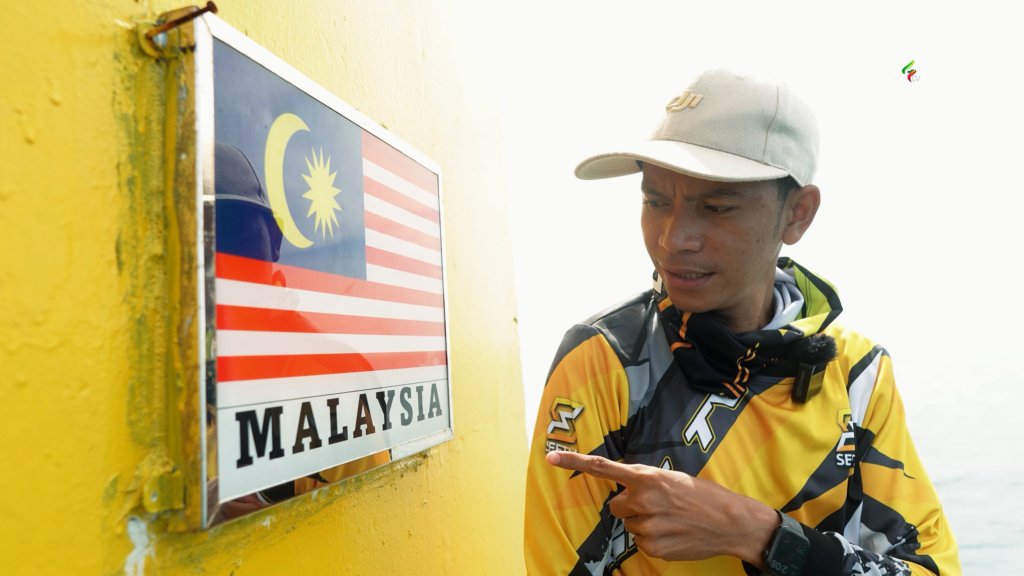
From North Mangsee, we took a short five-minute detour to find one of the giant boundary markers that separate the Philippines and Malaysia. Standing at the top of it, I could see Sabah on one side and Mangsee of Balabac on the other, with the Balabac mainland far in the distance. The marker was huge — and besides the one we climbed, there are four more.
Touchdown Mangsee
As we approached Mangsee, our phones buzzed with a strange text from Globe and Smart welcoming us to Malaysia. The Balabac mainland is so far away that phones here often catch the signal coming from towers on the Malaysian side instead.
We landed at Purok 4, one of only four puroks on the island. Word of a visitor spreads fast in a place like this. Children spotted me right away — one even shouted, “Look! That’s Seftv!” We stayed at our guide’s house, our home until the next day.
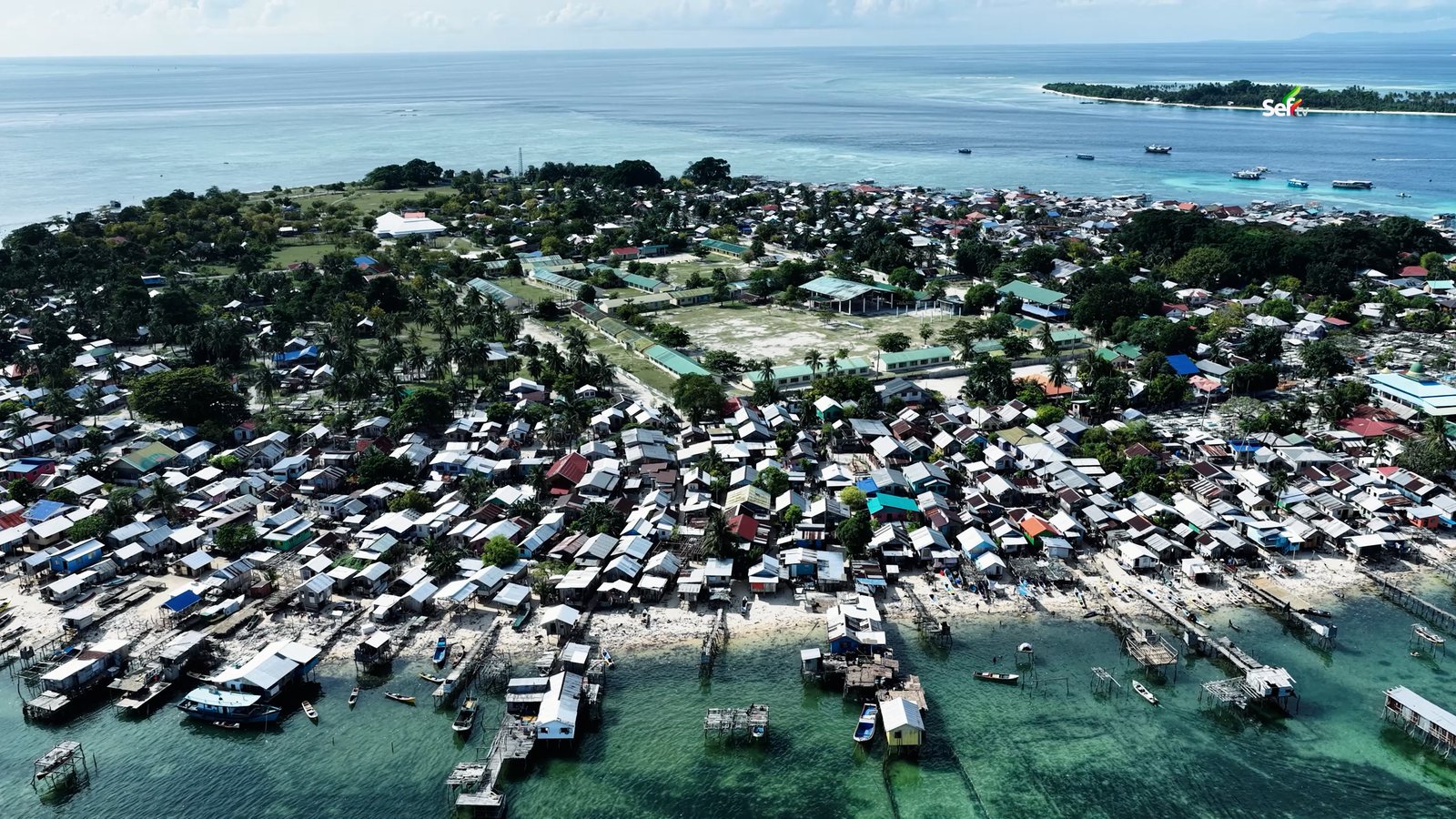
Mangsee covers a little over forty hectares at the very end of Palawan, yet it is home to more than ten thousand residents — more crowded, in fact, than many town centers. The nearest island under Malaysian control is only fifteen kilometers away, far closer than the center of Balabac. One resident told me that a strong person could reach Malaysian waters by paddle alone, no engine needed.
That closeness shapes everything. Most goods on the island come from Malaysia because they are cheaper — gasoline, instant noodles, canned goods, even Coca-Cola in bottles whose labels we could no longer read. I tried one. It tasted exactly the same as ours; only the name on the label was different. In one cluster of stores selling Malaysian products, I joked that there was no Smart signal on the island — because there, “Smart” is a brand of detergent soap.
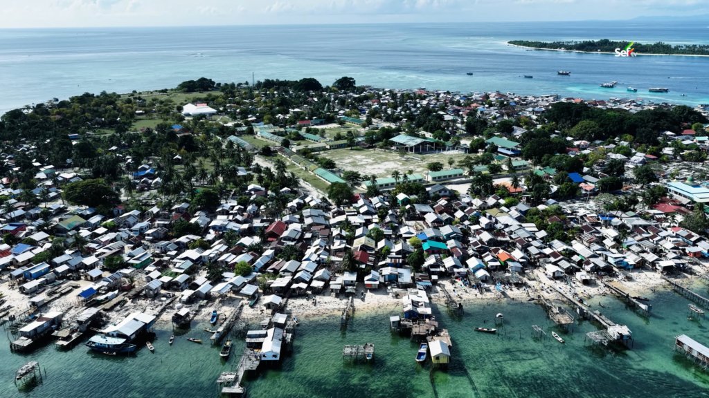
The island surprised me again and again. There is a department store in the middle of it, selling ready-to-wear clothes and malong. There are elementary and high schools, a hospital bigger than I expected, a park, and even a prison. A roving ukay-ukay seller pushed his secondhand clothes from Zamboanga around the island — the first time I had ever seen ukay-ukay sold on wheels. Motorcycles, all shipped from Puerto Princesa, zipped along sandy paths since there are no concrete roads in the interior. There is even an ATM service, and yes, they accept GCash. With all the twisting alleys between houses, I honestly lost track of where we were.
One thing amazed me about the land itself: dig almost anywhere and you will find fresh water, even near the edge of the sea. The locals believe the island’s unusual sand is the reason. The surface sand is black, but dig a little and it turns white underneath — acting like a natural filter that keeps the salt water out.
At the port in District 3, boats of every size and shape crowded the shore, and houses by the sea came with their own “boat garages.” An elder told me that in the old days, far fewer people lived there. The original families are like his, while most residents today trace their roots to Tawi-Tawi.
Connected, Welcoming, and Safe
Mangsee may sit at the edge of the country, but it is no longer cut off from the world. Thanks to Starlink, an island where people once barely knew Facebook or YouTube is now online and keeping up with the trends. Almost every person I met carried a cellphone.
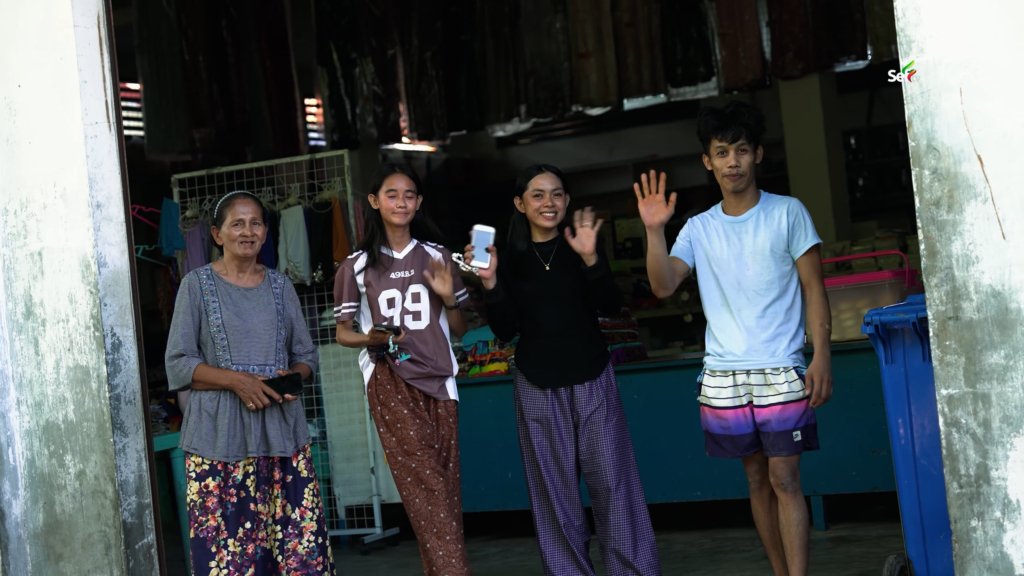
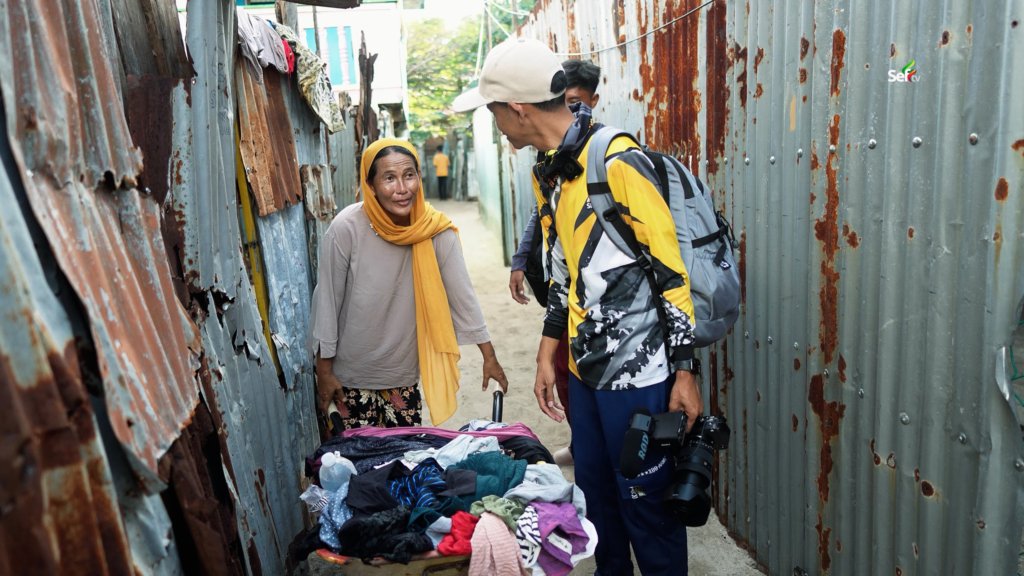
What I will remember most, though, is the warmth. As we were about to board our boat and leave, someone chased after us — not to ask for anything, but to invite us to eat. They did not know us, and we did not know them, yet a meal was laid out for strangers. That is the kind of people Mangsee has.
And to those asking whether it is safe to visit: we spent the night there, walked around even after dark, and explored the island freely. We had no problems at all. Our stay on Mangsee Island was smooth from start to finish — proof that at the farthest edge of the Philippines, you will still find the warmest welcome.
Watch the full expedition
Frequently Asked Questions About Mangsee Island, Balabac
Mangsee is a remote island barangay of Balabac, Palawan, sitting at the very end of the Philippines on the maritime border with Malaysia. The nearest island under Malaysian control is only fifteen kilometers away — far closer than the town center of Balabac itself. One resident told us a strong person could reach Malaysian waters by paddle alone, no engine needed. The island covers a little over forty hectares in the stretch of the Sulu Sea that opens into the West Philippine Sea, and it’s home to more than ten thousand people, most of them Muslim, some with Malaysian roots.
Our trip took one hour by air, five hours by land, and about six more hours on the water. After the flight to Palawan and the long drive south, we spent the night in the town center of Balabac, about forty kilometers from the southern tip of the mainland, traveling with Isla Malaya Travel and Tours. The next morning we crossed roughly an hour and a half to Lumbucan Island, then switched to a smaller traditional boat with no outriggers — less stable-looking, but locals say faster in high waves — for the final ninety-minute-plus run to Mangsee. This last stretch crosses open sea where strong currents and high waves are considered normal conditions.
Our own experience was smooth from start to finish. We spent the night on the island, walked around even after dark, and explored freely without a single problem — and the moment we’ll remember most is a stranger chasing after us at departure, not to ask for anything, but to invite us to eat. That said, this is a remote border area where sea conditions are the real daily hazard, so travel with an experienced local boatman, coordinate with the barangay or a local tour operator, and check current advisories before you go.
Because the Malaysian cell towers are closer than the Philippine ones. As our boat approached the island, our phones buzzed with roaming texts from Globe and Smart welcoming us to Malaysia — even though we never left Philippine territory. The Balabac mainland is simply too far away, so handsets on Mangsee often latch onto the signal coming across the water from the Malaysian side. It’s the single strangest proof of how close the border really is.
More than ten thousand residents live on a little over forty hectares, divided into just four puroks — making Mangsee more crowded than many mainland town centers. An elder told us that in the old days far fewer people lived there; his family is among the originals, while most residents today trace their roots to Tawi-Tawi. The alleys between houses twist so much that we honestly lost track of where we were, and at the District 3 port, seaside houses come with their own “boat garages.”
Yes. On the crossing from Lumbucan, the mountains of Sabah came into view while we were still in Philippine waters — we could even make out the Malaysian flag from afar. Near North Mangsee, we took a five-minute detour to one of the giant boundary markers that separate the two countries and climbed to the top: Sabah on one side, Mangsee and Balabac on the other, the Palawan mainland far in the distance. Besides the one we climbed, there are four more markers along the border.
Most goods come from Malaysia because they’re cheaper — gasoline, instant noodles, canned goods, even Coca-Cola in bottles with labels we could no longer read. I tried one; it tasted exactly the same. The island has a department store selling ready-to-wear clothes and malong, elementary and high schools, a hospital bigger than we expected, a park, a prison, and ATM service — and yes, they accept GCash. A roving ukay-ukay vendor even pushes secondhand clothes from Zamboanga around the island on wheels. Motorcycles, all shipped in from Puerto Princesa, run along sandy paths, since the interior has no concrete roads.
Yes — thanks to Starlink, an island where people once barely knew Facebook or YouTube is now online and keeping up with the trends. Almost every person we met carried a cellphone. The catch is the regular mobile networks: because Malaysian towers are closer than Philippine ones, local signal often arrives as Malaysian roaming, complete with “Welcome to Malaysia” texts.
Dig almost anywhere on the island — even near the edge of the sea — and you’ll find fresh water. Locals believe the island’s unusual sand is the reason: the surface is black, but a little digging reveals white sand underneath, which they say acts as a natural filter keeping the salt water out. For an island of ten thousand people forty hectares wide, that quirk of geology is what makes life possible.
Lumbucan is the first stop on the way to Mangsee, about an hour and a half by boat from the Balabac town center — and although it sits closer to the mainland, it actually falls under barangay Mangsee. The children there speak Tagalog but told us their own language is Ubian. The sand is so fine it feels like cement powder, and the houses come in matching colors — orange roof with orange walls, blue with blue. What moved us most was the sharing culture: fish laid out on the shore wasn’t for sale. When someone catches something, part of it goes to relatives and neighbors.